List of Figures
|
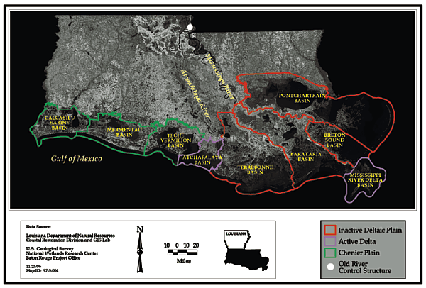
Figure 1. Hydrologic basins comprising Louisiana's active delta, inactive deltaic |
3 |
|
Figure 2. Ten states with the most coastal wetlands |
4 |
|
Figure 3. Commercial landings of fish for continental United States |
5 |
|
Figure 4. Brown shrimp life cycle |
5 |
|
Figure 5. Theoretical relationship between length of land-water interface |
6 |
|
Figure 6. Tracks of hurricanes to hit the coast of Louisiana this century |
6 |
|
Figure 7. Total water-borne commerce in the United States |
7 |
|
Figure 8. Historic wetland loss and gain for coastal Louisiana |
8 |
|
Figure 9. Current average land loss rates |
10 |
|
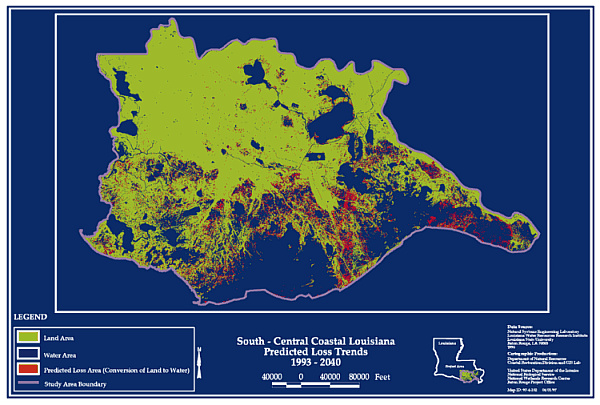
Figure 10. South-Central coastal Louisiana predicted loss trend from 1993 - 2040 |
11 |
|
Figure 11. CWPPRA program structure for Louisiana |
13 |
|
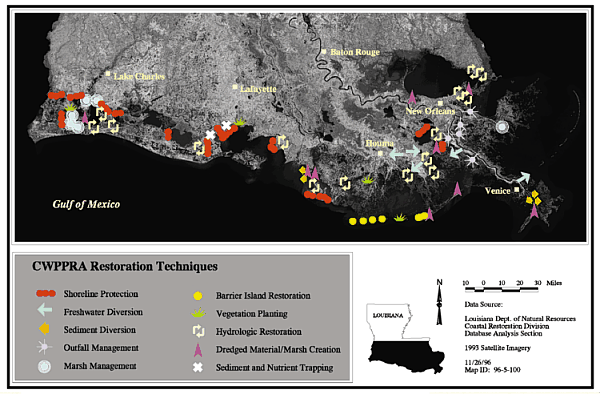
Figure 12. Restoration techniques for CWPPRA projects in coastal Louisiana |
14 |
|
Figure 13. CWPPRA 6th Priority List project locations |
23 |
|
Figure 14. Mississippi River Delta Basin CWPPRA project boundaries |
25 |
|
Figure 15. Development of deltaic marshes over time for a crevasse-splay |
26 |
|
Figure 16. Atchafalaya River Delta Basin CWPPRA project boundaries |
28 |
|
Figure 17. Pontchartrain Basin CWPPRA project boundaries |
30 |
|
Figure 18. Bayou La Branche (PPO-10), GIS analysis |
32 |
|
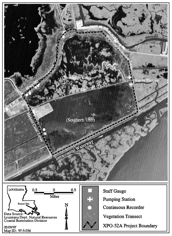
Figure 19. Project boundary and features for Bayou Sauvage Hydrologic Restoration |
35 |
|
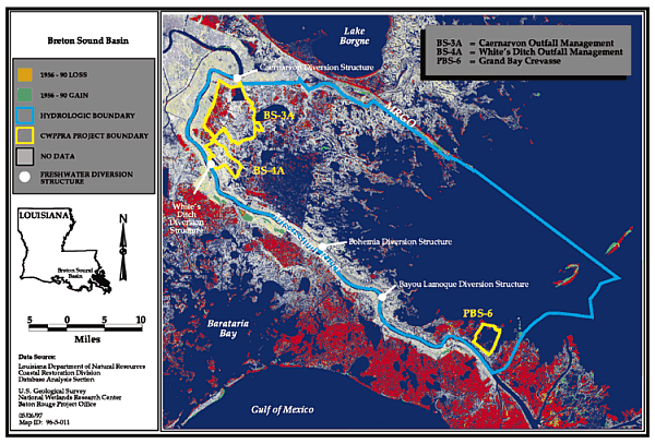
Figure 20. Breton Sound Basin CWPPRA project boundaries |
37 |
|
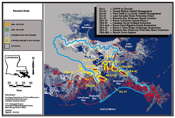
Figure 21. Barataria Basin CWPPRA project boundaries |
38 |
|
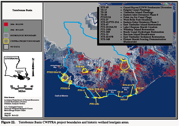
Figure 22. Terrebonne Basin CWPPRA project boundaries |
42 |
|
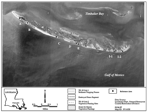
Figure 23. Timbalier Island Plantings project elements |
45 |
|
Figure 24. Timbalier Island dune development and plantings |
46 |
|
49 | |
|
Figure 26. Helicopter view looking down Boston Canal |
53 |
|
Figure 27. Elevational profiles before (5/19/91) and after (10/1/94) construction |
53 |
|
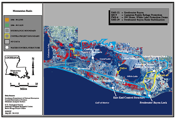
Figure 28. Mermentau Basin CWPPRA project boundaries |
55 |
|
61 | |
|
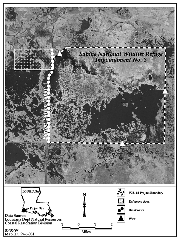
Figure 30. Sabine Refuge Erosion Protection (FCS-18) project area map |
66 |
|
68 | |
|
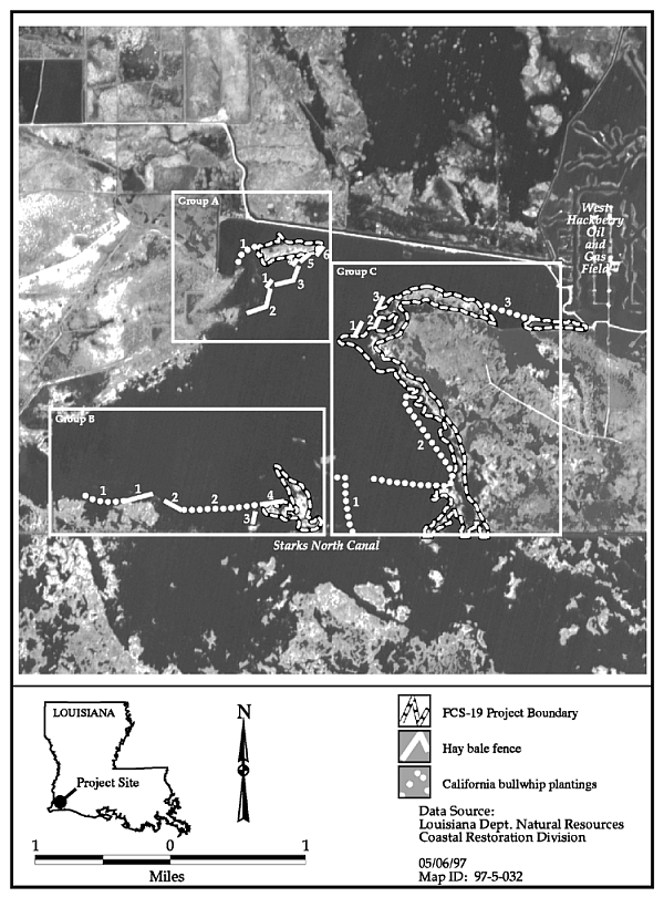
Figure 32. California bulrush plantings at West Hackberry |
69 |
|
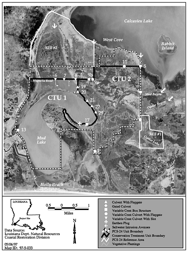
Figure 33. East Mud Lake (PCS-24) project area |
71 |
|
Figure 34. A comparison of average project size |
72 |
Previous Section
Contents.htm
Next Section
Back to LA
Coast